Plats, Subdivisions & Abstract
Subdivision Ownership Plat (PDF)
Subdivision Ownership Plat dwg (ZIP file)
- Browse through the folders until you find the desired subdivision name.
- Click on the folder.
- Click on a PDF file to view the subdivision image.
- Browse through the folders until you find the desired name.
- Click on the folder.
- Click on a PDF file to view the document.
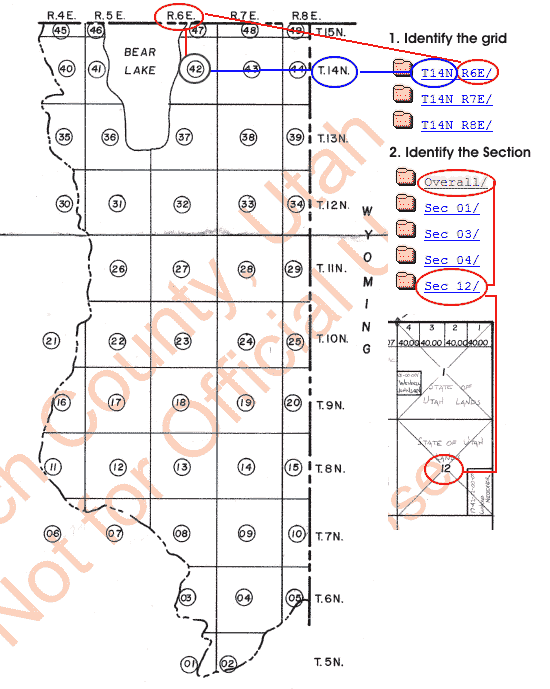
- To visually find the a plat view the map below or open the County Grid PDF and identify the plat number.
The numbers in the file name are the grid coordinates.
ie. T05N R6E = T.05N & R.6.E - Click to view the Ownership Plats folder list.
- Click the plat number folder and open the 'Overall' folder then the PDF file to view the Section image. Identify the Section Number.
Click your Back browser button to return to the folders.
Click on the desired Section link then the PDF file.
